The calm start to the chase was about to
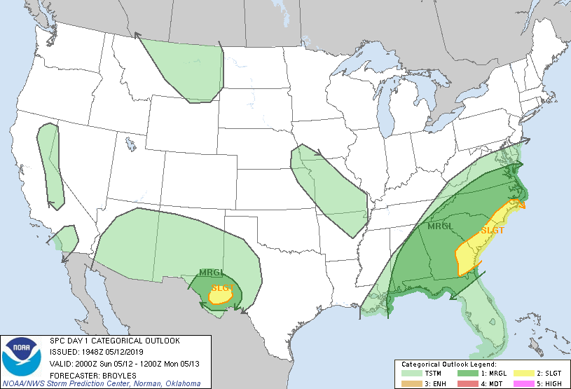
end. The SPC had placed an area a few hours to our south in a Marginal risk for
severe weather. Marginal indicates that some of the necessary ingredients for
severe thunderstorms were coming together, but it wasn’t a significant threat.
We interpreted the data to mean there was the potential for a supercell
thunderstorm or two, but it wouldn’t produce much in the way of severe weather
(NWS defines a severe thunderstorm as one that produces hail > 1” in
diameter, wind gusts > 58 mph, a funnel cloud, or a tornado).
In other words, we were prepared to drive
quite a distance for a photogenic storm and maybe some small hail. Such is
chasing; you play the cards you are dealt. And with a pattern expected to
remain calm for the next five days, we threw our chips into the pile and drove
south.
As we drove south we noted some
development. One particular storm started to exhibit severe characteristics on
radar, but it fell apart on its approach to Hobbs, NM. This showed us that the
potential was there but something was missing, possibly the necessary
instability to sustain the storm.
We stopped for lunch in Odessa, TX then
moved south towards Ft. Stockton. Another storm formed to our southwest. This
was enough for the SPC to upgrade a Slight Risk and issue a Severe Thunderstorm Watch for the area.
We moved into
position to intercept the storm. The storm was not severe, but it was
interesting to look at it. We found a place where we could view the bulk of the
storm. It was an opportunity for the students to observe the mechanics of the
storm and the parts which make it up. For example, we saw air rising and
condensing as it moved into the updraft portion of the cloud.
 |
| Storm in the Sierra Madera astrobleme. Low clouds are rising into the main updraft. Photo: Hunter Reeves |
 |
| Closer view of the storm. Lighter colors above the base might (might) have been some small hail. Maybe. Photo: Maddie Bernabei |
 |
| Watching the storm. |
But that was about
it. We did manage to get rained on, which was an achievement in itself. After
a few minutes of heavy rain, and with intensity trending downward on radar, we
left the storm behind. We took a restroom break outside Odessa and made our way
to Midland for dinner. Cracker Barrel was the choice for tonight. They think
highly of their dumplings and will be more than happy to serve them to you in
abundance. They also believe it is a vegetable....
The dumplings would
turn out to be more plentiful than the storms for the next week.


No comments:
Post a Comment